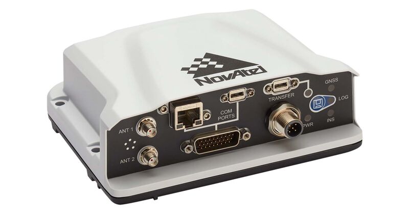
PwrPak7D-E1™
The PwrPak7D-E1 is a robust, high-precision receiver that has multi-frequency, dual antenna input and provides industry leading Global Navigation Satellite System (GNSS) multi-constellation heading and position data. These capabilities make the PwrPak7D-E1 ideal for ground vehicle, marine or aircraft based systems.
NovAtel’s world class Synchronous Position, Attitude and Navigation (SPAN®) technology brings together GNSS positioning and inertial navigation to provide an exceptional 3D navigation solution that is stable and continuously available.
The PwrPak7D-E1 has a powerful OEM7® GNSS engine, integrated Epson G320N MEMS IMU, built-in Wi-Fi, on board NTRIP client and server support and 16 GB of internal storage.
![]()
Features
- SPAN enabled enclosure featuring NovAtel’s tightly coupled GNSS+INS engine
- Enhanced connection options including serial, USB, CAN and Ethernet
- 555 channel, all-constellation, multi-frequency positioning solution
- Multi-channel L-Band supports TerraStar correction services
- Multiple communication interfaces for easy integration and installation
- Built-in Wi-Fi support
- 16 GB of internal storage
- ALIGN® heading solution
Attributes
| System Type | Enclosed | |
| General Info | Length (mm) | 147 |
| Width/Diametre (mm) | 125 | |
| Height (mm) | 55 | |
| Weight (g) | 510 | |
| Typical Power Consumption (W) | 1.8 | |
| Signal Tracking | ||
| Primary RF | ||
| GPS | L1 C/A, L1C, L2C, L2P, L5 | |
| GLONASS | L1 C/A, L2 C/A, L2P, L3, L5 | |
| BeiDou | B1, B2 | |
| Galileo | E1, E5 AltBOC, E5a, E5b | |
| NAVIC (IRNSS) | L5 | |
| SBAS | L1, L5 | |
| QZSS | L1 C/A, L1C, L2C, L5 | |
| L-Band | Up to 5 channels | |
| Secondary RF | ||
| GPS | L1 C/A, L1C, L2C, L2P, L5 | |
| GLONASS | L1 C/A, L2 C/A, L2P, L3, L5 | |
| BeiDou | B1, B2 | |
| Galileo | E1, E5 AltBOC, E5a, E5b | |
| NavIC (IRNSS) | L5 | |
| QZSS | L1 C/A, L1C, L2C, L5 | |
| Number of Com Ports | RS-232 | 1 |
| RS-232/RS-422 Selectable | 2 | |
| USB Device | 1 | |
| USB Host | 1 | |
| Ethernet | 1 | |
| CAN Bus | 1 | |
| Event Inputs | 3 | |
| Event Outputs | 3 | |
| Pulse Per Second Output | 1 | |
| Quadrature Wheel Sensor Input | 1 | |
| Performance | Accuracy | (RMS) |
| Single Point L1 | 1.5 m | |
| Single Point L1/L2 | 1.2 m | |
| SBAS | 60 cm | |
| DGPS | 40 cm | |
| PPP | ||
| TerraStar-L | 40 cm | |
| TerraStar-C | 4 cm | |
| RTK | 1 cm + 1 ppm |

