Applications
In a short book, it is impossible to describe all GNSS applications. We will highlight some of the commercial applications, including:
- Consumer
- Ground Mapping
- Transportation
- GIS
- Machine Control
- Port Automation
- Precision Agriculture
- Timing
- Construction
- Marine
- Mining
- Unmanned Vehicles
- Surveying
- Defense
- Aerial Photogrammetry
Consumer
GNSS technology has been adopted by the consumer market, in an ever-increasing range of products.
GNSS receivers are now routinely integrated into smartphones, to support applications that display maps showing the location of and best route to stores and restaurants.
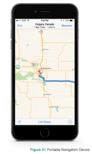
Portable navigation devices give drivers directions on road or off, as shown in Figure 51.
Geocaching is an outdoor activity in which participants use a GNSS receiver to hide and seek containers (called “geocaches” or “caches”) around the world.
Currently, most GNSS consumer products are based on GPS, but this will change as more GNSS constellations are implemented.
Transportation
"I knew I was going to take the wrong train, so I left early." Yogi Berra
In rail transportation, GNSS is used in conjunction with other technologies, to track the location of locomotives and rail cars, maintenance vehicles and wayside equipment, for display at central monitoring consoles. Knowing the precise location of rail equipment reduces accidents, delays, and operating costs, enhancing safety, track capacity, and customer service.
In aviation, GNSS is being used for aircraft navigation from departure, en route, to landing. GNSS facilitates aircraft navigation in remote areas that are not well served by ground-based navigation aids, and it is a significant component of collision avoidance systems, and of systems used to improve approaches to airport runways. Refer to “Wide Area Augmentation System (WAAS)” in Chapter 5 for information about WAAS, a US system that delivers GPS corrections and a certified level of integrity to the US aviation industry, enabling aircraft to conduct precision approach to airports.
In marine transportation, GNSS is being used to accurately determine the position of ships when they are in open sea and also when they are maneuvering in congested ports. GNSS is incorporated into underwater surveying, buoy positioning, navigation hazard location, dredging, and mapping.
In surface transportation, vehicle location and in-vehicle navigation systems are now being used throughout the world. Many vehicles are equipped with navigation displays that superimpose vehicle location and status on maps. GNSS is used in systems that track and forecast the movement of freight and monitor road networks, improving efficiency and enhancing driver safety.
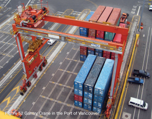
Port Automation
Using GNSS, shipping hubs can improve their operating efficiency by tracking the movement and placement of containers about their yards.
Driver Testing in China
The automotive market is booming in China. In 2001, there were only 5 million cars driving the roads in China. By the end of 2012, the number of cars had reached 120 million. This huge increase in cars also means a huge increase in new drivers. To manage the testing of all these new drivers, the Chinese government has instituted an automated test as part of the drivers license test. In the automated test, the new drivers are required to perform a series of standard driving tasks, such as parking, turning, stopping, etc., on a surveyed course at a licensing facility. To automate the test, the licensing facilities use a GNSS system installed in the car to monitor and evaluate the driver. The GNSS system installed on the car uses dual antennas so that the GNSS system can not only monitor the car’s position and speed, but also detect the direction the car is going (heading).
An article (Road Test) about how GNSS is used for driver license testing is in the 2013 Velocity magazine available at: www.novatel.com/technology-in-action/velocity/.
Parking Automation
In the Canadian city of Calgary, paying for on street parking has become automated. Customers pay for parking at street side terminals or using their smartphone and monitoring of the parked vehicles is done from a vehicle equipped with cameras and GNSS receiver.
When a customer pays for parking, they enter the license plate of their vehicle, a code that identifies the parking area and the amount of parking time required. This information is sent to a database. As the monitoring vehicle drives along the street, the vehicle cameras capture the license plates of the parked cars. The license plate number, along with the time and position provided by the GNSS receiver, is compared to the database of paid parking. If a vehicle is not found in the database, the photograph is sent to a Calgary Parking Authority employee so they can determine if there is a just cause (e.g. people are just getting out of car), there is a mistake in identifying the license plate (e.g. a D is mistaken for an O) or if it is a parking violation.
Due to the tight urban corridors in downtown Calgary, the location reported by the GNSS only system on the monitoring vehicles was misplacing 6-7% of the vehicles (approximately 1,400 vehicles) per day and the vehicles could be misplaced by up to 600 metres. This misplacement caused many hours of extra work each day for Calgary Parking Authority employees, because they have to manually correct the vehicles position before they can determine if there was a parking violation.
By switching from a GNSS only system to a GNSS+INS system, the monitoring vehicle was able to overcome the GNSS challenges in downtown Calgary and provide a much more reliable position. The GNSS+INS system reduced the number of misplaced cars to 1% (less than 300) saving the Calgary Parking Authority enough work hours to pay for GNSS+INS system in all of their monitoring vehicles in under two years.
An article (Calgary ParkPlus Program, City-Wide Positional Accuracy) about how GNSS+INS has helped the Calgary Parking Authority is in the 2014 Velocity magazine available at: www.novatel.com/technology-in-action/velocity/.
Machine Control
GNSS technology is being integrated into equipment such as bulldozers, excavators, graders, pavers and farm machinery to enhance productivity in the realtime operation of this equipment, and to provide situational awareness information to the equipment operator. The adoption of GNSS-based machine control is similar in its impact to the earlier adoption of hydraulics technology in machinery, which has had a profound effect on productivity and reliability.
Some of the benefits of GNSS-based machine control are summarized below:
Efficiency: By helping the equipment operator get to the desired grade more quickly, GNSS helps speed up the work, reducing capital and operating costs.
Accuracy: The precision achievable by GNSSbased solutions minimizes the need to stop work while a survey crew measures the grade.
Job Management: Managers and contractors have access to accurate information about the jobsite, and the information can be viewed remotely.
Data Management: Users can print out status reports, save important data and transfer files to head office.
Theft Detection: GNSS allows users to define a “virtual fence” about their equipment and property, for the purpose of automatically raising an alarm when equipment is removed, then providing equipment tracking information to the authorities.
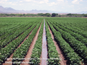
Precision Agriculture
"Farming looks mighty easy when your plough is a pencil, and you're a thousand miles from the corn field." Dwight D. Eisenhower, thirty-fourth U.S. president
In precision agriculture, GNSS-based applications are used to support farm planning, field mapping, soil sampling, tractor guidance, and crop assessment. More precise application of fertilizers, pesticides and herbicides reduces cost and environmental impact. GNSS applications can automatically guide farm implements along the contours of the earth in a manner that controls erosion and maximizes the effectiveness of irrigation systems. Farm machinery can be operated at higher speeds, day and night, with increased accuracy. This increased accuracy saves time and fuel, and maximizes the efficiency of the operation. Operator safety is also increased by greatly reducing fatigue.
Construction
GNSS information can be used to position the cutting edge of a blade (on a bulldozer or grader, for example) or a bucket (excavator), and to compare this position against a 3D digital design to compute cut/fill amounts. “Indicate systems” provide the operator with visual cut/fill information, via a display or light bar, and the operator manually moves the machine’s blade or bucket to get to grade. Automatic systems for bulldozers/graders use the cut/fill information to drive the hydraulic controls of the machine to automatically move the machine’s blade to grade. Use of 3D machine control dramatically reduces the number of survey stakes required on a job site, reducing time and costs. Productivity studies have repeatedly shown that the use of 3D machine control results in work being completed faster, more accurately and with significantly less rework than conventional construction methods.
Surface Mining
GNSS information is being used to efficiently manage the mining of an ore body and the movement of waste material. GNSS equipment installed on shovels and haul trucks provides position information to a computer-controlled dispatch system to optimally route haul trucks to and from each shovel. Position information is also used to track each bucket of material extracted by the shovel, to ensure that it is routed to the appropriate location in the mine (crusher, waste dump, leach pad). Position information is used by blast hole drills to improve fracturization of the rock material and control the depth of each hole that is drilled, to keep the benches level. Multi-constellation GNSS is particularly advantageous in a surface mining environment due to the obstructions caused by the mine’s walls. More satellites means more signal availability.
Automated Blast Hole Drilling
Automated drills are used in surface mines to increase safety and productivity. A single operator, located in the safer control room, can operate and monitor up to five automated drills.
The blast holes drilled by the automated drills must be very precise both horizontally and vertically. The position of the 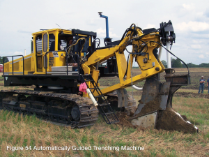
Three GNSS technologies are used on the automated drills, RTK, heading and multi-constellation. RTK provides the precise positioning needed to accurately locate the blast holes. Heading provides the alignment of the drill to ensure the holes are drilled perpendicular. Multi-constellation receivers compensate for signal blockages common in the high wall environment typical of surface mines.
An article (The Pit, The Bit and The Benefit) about how GNSS is used in automated drilling is in the 2013 Velocity magazine available at: www.novatel.com/technology-in-action/velocity/.
Survey
GNSS-based surveying reduces the amount of equipment and labour required to determine the position of points on the surface of the Earth, when compared with previous surveying techniques. Using GNSS, it is possible for a single surveyor to accomplish in one day what might have taken a survey crew of three people a week to complete.
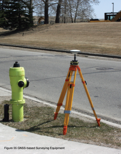
Using GNSS, surveyors can now set up a DGNSS or RTK base station over an existing survey point and a DGNSS or RTK rover over the new point, then record the position measurement at the rover. This simplification shows why the surveying industry was one of the early civilian adopters of GNSS technology.
Seismic Survey Sensors
In a seismic survey, sound waves are sent from a source (explosives or a thumper truck) through the ground to an array of sensors (geophones). Knowing the exact location and orientation of the geophones is critical for a successful survey.
Using traditional geophones, the placement of the geophones was a two step process. First a team surveys the area and places markers for each geophone. Later, a second team places the geophones precisely on the marked locations and then orients the geophones using a direction measuring device, such as a compass.
Using GNSS enabled geophones, eliminates the need to survey the area first. The GNSS enabled geophones have a GNSS receiver and dual antennas integrated in the geophone. The receiver and dual antennas allows the geophone to not only determine its exact location, but also its orientation.
An article (Building a Better Geophone) about how GNSS is used to simplify geophone placement is in the 2013 Velocity magazine available at: www.novatel.com/technology-in-action/velocity/.
Aerial Photogrammetry
Aerial photogrammetry refers to the recording of images of the ground (photographs, for example) from an elevated position, such as an aircraft. Systems of this type are now more generally referred to as “remote sensing,” since the images can be taken from aircraft or from satellites.
In the past, images would have to be manually corrected for orientation, perspective and the height of the camera and location, and manually “stitched” together. This manual process would be based on the accurate alignment of known points in adjacent pictures.
By integrating the camera with GNSS and INS, it is now possible to automate the process, in real time or post-mission, to “transfer” the location accuracy of the aircraft, determined from GNSS, to the image.
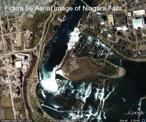
Aerial photographs are used in online map systems such as Google Earth. Many of us have found our houses, and perhaps even our cars, through these applications.
GNSS technology has also been integrated with LiDAR (Light Detection and Ranging), an optical remote sensing technology used to measure range to distant targets. It is possible to image a feature or object down to the wavelength, which at LiDAR frequencies is less than a millionth of a metre.
Mapping Wildfires
To battle wildfires, fire fighters need to know the locations of the fires and any hotspots. Using an airplane equipped with an infrared imaging sensor and a GNSS+INS system, the locations of the fires and hotspots can be projected on topographical or 3D terrain maps.
An article (Custom Airborne Mapping Solutions) about how GNSS is used in aerial mapping is in the 2014 Velocity magazine available at: www.novatel.com/technology-in-action/velocity/.
Ground Mapping
Products have been developed that take 360-degree panoramic photographs to support the presentation of geometrically correct images on a computer screen. These images are continuous and precisely positioned. GNSS and IMU data is recorded before the panoramic photographs are taken. Position and attitude data is programmed into the cameras, allowing onscreen determination of positions of objects in the photos, or measurements between objects.
Infrastructure Visualization
Using a LiDAR system combined with a GNSS+INS system, a user can capture comprehensive visual information of key infrastructure, such as oil and gas pipelines. This visual information provides the state, location and positioning of the infrastructure and its related assets. It also assists in planning for maintenance and modifications.
An article (Seeing is Believing) about how GNSS and LiDAR are used for infrastructure visualization is in the 2014 Velocity magazine available at: www.novatel.com/technology-inaction/velocity/.
Geospatial Information Systems (GIS)
"The clock, not the steam engine, is the key-machine of the modern industrial age." Lewis Mumford, American historian of technology and science
Time Applications
As we mentioned in earlier chapters, time accuracy is critical for GNSS position determination. This is why GNSS satellites are equipped with atomic clocks, accurate to nanoseconds. As part of the position determining process, the local time of GNSS receivers becomes synchronized with the very accurate satellite time. This time information, by itself, has many applications, including the synchronization of communication systems, electrical power grids, and financial networks. GNSS-derived time works well for any application where precise timing is needed by devices that are dispersed over a wide area.
Seismic monitors that are synchronized with GNSS satellite clocks can be used to determine the epicenter of an earthquake by triangulation based on the exact time the earthquake was detected by each monitor.
Marine Applications
In the Foreword, we discussed the challenges that early explorers had determining their position when at sea. With the advent of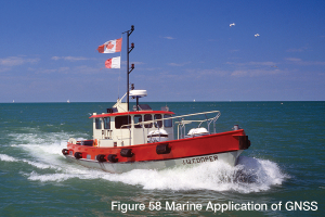
In addition to dramatically improving marine navigation, GNSS is also being applied to a broad range of marine applications, such as oilrig positioning, underwater cable and pipeline installation and inspection, rescue and recovery, and the dredging of ports and waterways.
GNSS-Equipped Sonobuoys
An interesting application of GNSS is the use of GNSS-equipped sonobuoys in underwater sonar systems.
Sonobuoys are dropped from aircraft over an area of interest, but are left to float autonomously. The sonobuoys detect approaching ships and other hazards in the water by transmitting sound waves through the water, detecting reflections from vessels and objects, and determining the time it takes for the “echo” to be received. The data comes up to the sonobuoy’s float then is transmitted, with GNSS positioning data, over a radio link to a survey ship. The survey ship collects and analyzes sonar data from a larger number of sonobuoys then determines and displays the location of ships and objects in the area of interest.
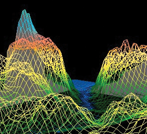
Seafloor Mapping
Knowing the depth of the seafloor in ports and navigation channels is critical to safe marine navigation. Maps of the ports and channels are created using bathymetric sonar systems.
Bathymetric sonar systems, mounted in a marine vessel, bounce sound waves off the seafloor to determine the depth of the water. Using these depth measurements, a map of the seafloor is created. For the seafloor maps to be accurate, the exact location of the vessel on the surface of the water must be known. A GNSS+INS system integrated with the sonar system provides the precise location of the vessel for each sonar measurement. The GNSS+INS system also provides the vertical location of the vessel to compensate for waves.
An article (Sounding the Depths) about how GNSS works with bathymetric sonar is in the 2014 Velocity magazine available at: www.novatel.com/technology-in-action/velocity/.
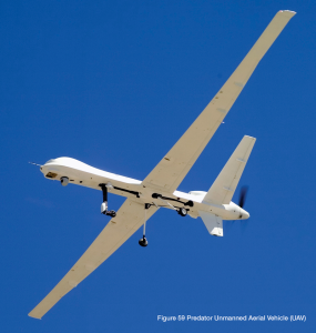
Unmanned Vehicles
An unmanned vehicle is a vehicle that is unoccupied but under human control, whether radio-controlled or automatically guided by a GNSS-based application. There are many types of unmanned vehicles, including: Unmanned Ground Vehicle (UGV), Unmanned Aerial Vehicle (UAV), Unmanned Surface Vehicle (USV) and Unmanned Underwater Vehicle (UUV).
Hurricane Research
Knowing where a hurricane will make land fall and how powerful it will be are important to properly prepare for the storm. While meteorologists are good at predicting the potential path of a hurricane it is much harder to predict how powerful the storm will be when it arrives.
To learn more about what causes a hurricane to rapidly increase or decrease in intensity, NASA is using two long range UAVs to study the storms while they are still far out to sea. Onboard the UAVs are meteorological instruments that monitor the environmental conditions in and around the storm. The UAVs also have a GNSS+INS system that records the UAV location and attitude for each measurement taken by the meteorological instruments. An accurate UAV location and attitude is necessary for the measurement take to be useful.
An article (Joining the Hunt) about the NASA project to study hurricane intensification is in the 2014 Velocity magazine available at: www.novatel.com/technology-in-action/velocity/.
Orion Spacecraft Parachute Testing
Before the Orion spacecraft can be used for manned space missions, NASA must know that Orion can safely land on earth. A key aspect of returning the astronauts safely to earth is slowing the Orion spacecraft from its incredibly high reentry speed of close to 32,000 km/h to less than 36 km/h. This is the job of the Capsule Parachute Assembly System (CPAS).
To test the CPAS, NASA created two unmanned test vehicles. These test vehicles are dropped out of a C-17 aircraft from altitudes as high as 35,000 feet. A GNSS+INS system installed in the test vehicles measures the vertical velocity of vehicle to test the effectiveness of parachute system.
An article (Put to the Test) about the Orion CPAS testing is in the 2014 Velocity magazine available at: www.novatel.com/technology-in-action/velocity/.
Landing an Unmanned Helicopter on a Ship
The autonomous landing of an unmanned helicopter is already challenging as the navigation system has to deal with the movement of the helicopter caused by the winds. This challenge is greatly increased when trying to land on a ship at sea. Not only is the helicopter’s position changing based on its movement and the affects of the wind, the ship is moving independently based on its movement and the affects of both the wind and the sea.
When landing a helicopter on a ship, the relative distance between the helicopter landing gear and the flight deck of the ship is much more important than the absolute position of the helicopter and ship. GNSS+INS systems installed on both the helicopter and the ship are used to determine this relative distance. The GNSS+INS system on the ship calculates its position and sends that information to the GNSS+INS system on the helicopter. The GNSS+INS system on the helicopter uses the position sent from the ship along with its own position to calculate the relative distance and direction between the ship and helicopter. Using this relative distance and direction, the unmanned helicopter is able to autonomously approach and land on the ship’s flight deck.
An article (From Fledgling to Flight) about the landing of the unmanned Little Bird helicopter on a moving ship is in the 2013 Velocity magazine available at: www.novatel.com/technology-inaction/velocity/.
Defence
The defence sector makes broad use of GNSS technology, including:
Navigation: Using GNSS receivers, soldiers and pilots can navigate unfamiliar terrain or conduct night-time operations. Most foot soldiers now carry hand-held GNSS receivers.
Search and Rescue: If a plane crashes and that plane has a search and rescue beacon that is equipped with a GNSS receiver, it may be possible to more quickly locate it.
Reconnaissance and Map Creation: The military uses GNSS to create maps of uncharted or enemy territory. They can also mark reconnaissance points using GNSS.
Unmanned Vehicles: Unmanned vehicles are used extensively in military applications, including reconnaissance, logistics, target and decoy, mine detection, search and rescue, research and development and missions in unsecured or contaminated areas.
Munitions Guidance: Precision munitions use GNSS to ensure the munition lands on target.