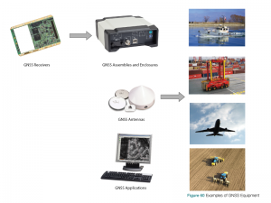
GNSS Equipment
The first generations of commercial GNSS receivers cost well over $100,000. Now, GNSS receivers are built into smartphones. Equipment vendors have developed a wide array of equipment to support the incredible range of GNSS applications that are now available. As illustrated in Figure 60, GNSS equipment consists of receivers, antennas and supporting software, in varying levels of integration and performance.
Depending on the application, the antenna and receiver may be separate entities, or they may be integrated into a single package, as in a handheld GNSS receiver. GNSS equipment may be further integrated with application equipment such as a survey or hydrographic instrumentation or a transport vessel.
GNSS equipment specifications and features depend on the application. To illustrate, users need to consider the following when selecting GNSS equipment for a particular use:
Accuracy: Applications such as survey may require centimetre-level accuracy. Others, such as positioning for hiking, may only require accuracy to within tens of metres. Some applications require absolute accuracy; that is, position defined accurately, relative to an actual reference point or location. Others may require accuracy relative to a previous position. If high-precision accuracy is obtained through the application of differential GNSS, it may be desirable that the differential service be integrated in the same package as the GNSS receiver, for example, the SBAS receiver or the radio link to the base station or rovers.
Acquisition Time: For some applications, users may require a fast “time to first fix,” the time required by a GNSS receiver to achieve a position solution. For other applications, it may not be important that the “fix” be available quickly. The trade-off to achieving fast acquisition time is increased probability of a wrong position/fix.
Reliability: Addresses the question, “Do you need the answer (position and time) to be correct every time?”
Availability: Equipment may be required to provide positioning service continuously, even in areas where signals from satellites are blocked. As we have discussed, these applications may best be served by equipment that integrates GNSS and INS equipment. Equipment may need to support multiple constellations and frequencies, and may need to perform well in environments characterized by a high level of multipath interference. Remember, from Chapter 4, multipath interference occurs because some of the signal energy transmitted by the satellite is reflected (and therefore delayed) on the way to the receiver. In the selection of GNSS equipment, there will almost always be tradeoffs between accuracy, acquisition time, reliability and availability.
Environmental: User equipment may have to operate over wide temperature and humidity ranges, at high altitudes, or in dusty environments. The equipment may need to be waterproof to rain or submersion.
Shock and Vibration: Equipment may be subjected to high levels of shock and vibration, such as that which is characteristic of industrial vehicles.
Portability: Depending on the application, the equipment may need to be portable, such as hand-held device for hiking or survey.
Regulatory: Regulatory compliance will vary with the jurisdiction in which the user is operating, for example:
- Emissions standards, such as FCC Part 15.
- Compliance with the European Union’s Restriction of Hazardous Substances (RoHS) directive.
- WEEE, the European Community directive that imposes responsibility for the disposal of waste electrical and electronic equipment on the equipment manufacturer.
Data Storage: Receivers may be required to store time-stamped range or position information for applications that will use this information post-mission.
Physical Size and Power Consumption: The user may require a receiver or antenna with a small form-factor and low power consumption for integration in a particular application, such as UAVs.
User Interface: The manner through which the user interacts with the equipment is important; for example, a keypad for entering commands, a screen for viewing position data on a map, or connectors for outputting data to other devices.
Computational Requirements: Users may require that the equipment provide computed data such as velocity or heading.
Communications: Position may only be useful if it is communicated to another device over, for example, a cellular radio link.
Future-Proof: Although some GNSS signals and constellations may not yet be available, users may require some assurance that they will be able to use these signals and constellations once they are available.
Closing Remarks
Like “cyberspace,” GNSS is already here, its broad acceptance and application is based on a track record of exceptional performance and reliability. Industry and government agencies are continually enhancing technology and infrastructure to enable the development of new GNSS-based solutions.
In this chapter, we have provided a broad sample of current GNSS applications to illustrate just how beneficial GNSS is–both in terms of cost efficiency and safety of life applications. GNSS technology is becoming truly ubiquitous— a prevalent, taken-for-granted technology in almost everything we do. GNSS anywhere, and anytime is here.